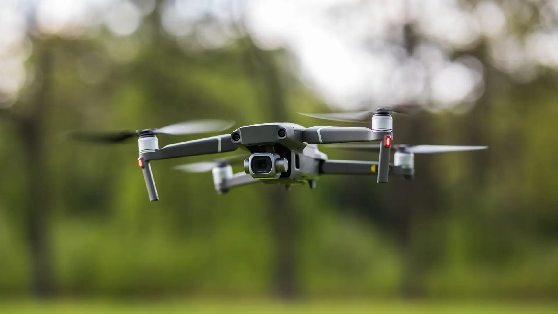
An inspection drone hovers three meters from the wind turbine blade, its camera capturing every millimeter of the composite surface. Then the wind gusts 40 mph from the northeast. For a split second, the drone shifts. But before a human pilot could even register the movement, the onboard IMU has already fired correction signals to all four motors. The drone steadies. The inspection continues flawlessly.
This split-second recovery isn’t magic. It’s physics, mathematics and sensor fusion working in perfect harmony. And it’s why the drone industry is projected to surpass $54 billion by 2030 built largely on one tiny component: the miniature IMU sensor.
The Foundation: Garbage In, Garbage Out
Here’s an uncomfortable truth about autonomous systems: they’re only as smart as the data they receive. Feed a flight controller noisy accelerometer readings or a drifting gyroscope signal, and even the most sophisticated AI will make catastrophic decisions. This is the GIGO principle, (Garbage In, Garbage Out), and it’s the silent killer of drone missions.
Consider a delivery drone attempting to land on a rooftop pad. If its IMU reports that it is level when it’s actually tilted 5 degrees, the landing gear hits at an angle. Best case: the package shifts. Worst case: a €15,000 drone tumbles off a building. The flight control algorithms didn’t fail, they executed perfectly based on bad information.
This is why precision at the sensor level isn’t just important; it’s everything. A miniature IMU sensor integrates accelerometers, gyroscopes and often magnetometers to detect acceleration, rotation and magnetic heading. But integration alone isn’t enough. The quality of those individual sensor readings determines whether your drone performs a ballet or a crash landing.
When GPS Goes Dark: Real Navigation Begins
MIT researchers have developed a drone capable of continuing missions in GPS starved areas, relying on IMU sensor fusion to continue a mission. Losing GPS signal 200 meters into a dense forest canopy triggers a “return to home” emergency for consumer drones. But this drone, equipped with advanced IMU sensor fusion, simply switches modes. Using dead reckoning, it calculates its position based on acceleration and rotation measurements. It can continue its grid search pattern for extended periods without GPS, finding a missing hiker and completing its mission.
This scenario repeats daily in urban canyons, indoor warehouses and under bridge spans. GPS signals weaken or disappear entirely, but missions must continue. A high-quality miniature IMU sensor becomes the primary navigation system, integrating motion data continuously to maintain accurate position estimates. However, this only works if the sensor data is clean. Noisy accelerometer readings compound into meter-scale position errors within seconds. Gyroscope drift turns a straight path into a spiral.
Sensor fusion software attempts to correct these issues by blending multiple imperfect signals into one reliable output, but it can’t manufacture accuracy from fundamentally flawed data. This is GIGO at the algorithmic level: even the most elegant Kalman filter can’t extract truth from noise.
The Payload Problem
A LiDAR-equipped drone scans a construction site, generating millions of 3D points per second. The resulting point cloud is supposed to create a precision model accurate to 2 centimeters. Instead, the data shows buildings that seem to ripple and walls that curve impossibly.
The problem? Micro-vibrations during flight. The IMU had not properly isolated and compensated for the drone’s motion, so every slight correction by the flight controller is translated into positional errors in the LiDAR data. The result? The survey must be repeated at the cost of thousands of dollars and days of delays.
Modern drones carry increasingly sophisticated payloads: multispectral cameras for agriculture, thermal sensors for power line inspection and radar systems for defense applications. These instruments demand rock-solid stability. Through IoT smart sensors integrated via an IoT sensor solution, the IMU coordinates with payloads to ensure measurements align with the drone’s actual position and orientation.
But here’s the critical insight: stabilization algorithms can only compensate for movements they accurately detect. If your IMU has a 0.1-degree bias error in pitch measurement, that error propagates through every correction cycle. Your thermal camera thinks it’s pointing at one section of power line when it’s actually imaging another. You miss the overheating connector. The line fails two weeks later.
Precision IMU data isn’t a nice-to-have feature, it’s the difference between actionable intelligence and expensive guesswork.
Sensor Fusion: The Art of Making Imperfect Perfect
No sensor is perfect. Accelerometers pick up vibration noise. Gyroscopes drift over time sometimes several degrees per hour. Magnetometers go haywire near metal structures. Individually, these sensors would be nearly useless for navigation. But through IMU sensor fusion, their complementary strengths create something remarkable.
The principle is straightforward: use each sensor’s strengths to compensate for others’ weaknesses. Accelerometers provide excellent short-term accuracy but accumulate errors quickly. Gyroscopes maintain accuracy over moderate time periods but drift eventually. Magnetometers offer absolute heading references but suffer from local distortions.
Sensor fusion software, often using Extended Kalman Filters or complementary filter algorithms, continuously weighs and blends these inputs. When integrated with visual or LiDAR data, the system builds a comprehensive understanding of the drone’s state that’s more accurate than any single sensor could provide.
But sensor fusion is not magic. It’s mathematics. Feed it low-quality sensor data, and the mathematics propagate those errors throughout the entire state estimate. A gyroscope with temperature-dependent drift characteristics can confuse some fusion algorithms, causing distrust in accurate accelerometer readings. The system’s confidence in its own position degrades. In autonomous modes, this triggers safety protocols and the mission aborts.
Quality sensor fusion requires quality sensor data. There is no algorithmic substitute for hardware excellence.
Real-World Applications: Where Precision Matters
Agricultural Drones: A precision spraying operation needs to maintain exact altitude and speed to apply the correct chemical dosage. Fly too low or too fast and you waste expensive pesticides. Fly too high or slow and you under-spray areas where pests will survive. The IMU, working through sensor fusion software with GPS and barometric sensors, maintains these parameters within millimeters and centimeters per second. In a 50-hectare field, this precision prevents thousands of dollars in waste.
Bridge Inspection: An inspection drone equipped with high-resolution cameras photographs every square meter of a suspension bridge’s underside. The images must align perfectly to create a comprehensive structural map. IMU errors encountered during flight can translate directly into image misalignment, creating gaps or overlaps in coverage. Inspectors miss cracks. The bridge fails catastrophic load testing. IMU sensor fusion ensures each photo’s position and orientation is known precisely, enabling perfect stitching of thousands of images into one analyzable model.
Warehouse Automation: Indoor drones navigate without GPS, relying on visual-inertial navigation, a fusion of camera data and IMU measurements that enables autonomous flight in GPS-denied warehouse environments. These drones verify inventory on 12-meter-high shelves, requiring position accuracy within centimeters. An IMU bias error compounds into positional drift of multiple meters over a flight that lasts even a few minutes. The drone thinks it’s scanning aisle 12 when it’s actually in aisle 11. Inventory data becomes worthless, leading to operations teams losing trust in autonomous systems.
Disaster Response: Following an earthquake, a response drone is deployed and it searches collapsed structures for survivors. GPS is unreliable amid debris and damaged infrastructure. The drone can navigate using its IMU, building a map of where it’s been and where it needs to search. Every few minutes, it will return to a known reference point to reset accumulated drift. This is only possible with low-drift IMU hardware, high-quality gyroscopes and accelerometers that maintain accuracy over extended periods. Poor sensor quality means the drone can’t find its way back out.
The Size-Performance Revolution
Ten years ago, IMU sensors with this level of performance filled boxes the size of textbooks and cost thousands of dollars. MEMS (Micro-Electro-Mechanical Systems) technology changed everything. Today’s miniature IMU sensors weigh a few grams, consume considerably less power and deliver performance that would have been considered military-grade a decade ago.
Advances in sensor technology are creating a powerful cycle of innovation in the drone industry. Lighter, more efficient sensors enable the development of smaller, more agile drones. These compact platforms can navigate tighter spaces and, when optimized for weight and power, achieve longer flight times. Extended missions allow each drone to cover more area per flight, improving efficiency and reducing operational costs. As small drones grow more capable and versatile, they open new markets and applications, fueling further demand for advanced, lightweight sensors and driving the next wave of technological progress.
But miniaturization brings challenges. Smaller MEMS structures are more susceptible to temperature variations, vibration coupling and electromagnetic interference. In manufacturing, precision is critical, variations of a few nanometers in MEMS structure dimensions can significantly impact sensor performance. This is where companies like 221e differentiate themselves: not just in making sensors small, but in making small sensors that maintain reliable performance across real-world operating conditions.
Smarter Sensors, Smarter Drones
Emerging IMU technology is advancing along three main frontiers: lower power consumption, tighter integration with edge AI processing and self-calibration capabilities. Imagine an IMU that continuously monitors its own performance, detects developing bias errors and automatically compensates before they impact navigation accuracy. Or sensors that adapt their sampling rates and filtering based on detected flight conditions high-rate sampling during aggressive maneuvers, power-saving modes during stable cruise.
These advances will enable truly autonomous drone swarms, multiple aircraft coordinating complex missions with minimal human oversight. But the foundation remains unchanged: high-quality sensor data. A swarm is only as reliable as its least accurate member. One drone with poor IMU data becomes a collision hazard to the entire formation.
As IoT sensor solution frameworks mature, drones will increasingly operate as nodes in larger sensing networks, sharing data with ground stations, other drones and cloud analytics platforms. This connectivity amplifies both the value of good data and the consequences of bad data. GIGO scales, so, feed garbage into a connected system, and that garbage propagates through every decision and analysis downstream.
Conclusion
Most people watching a drone fly see the aircraft, the camera, maybe the clever software. They don’t see the miniature IMU sensor firing thousands of readings per second, the sensor fusion algorithms blending imperfect signals into accurate state estimates, or the years of engineering that went into achieving 0.01-degree gyroscope stability.
But that invisible foundation is everything. It’s the difference between a drone that completes missions and one that crashes. Between data you can trust and data you must verify. Between autonomous systems that expand human capability and expensive toys that require constant supervision.
As the drone industry races toward that $54 billion future, success will belong to those who understand a fundamental truth: intelligence begins with information, and information quality begins at the sensor. There is no algorithm, no edge AI, no amount of processing power that can overcome fundamentally flawed input data.
In the world of autonomous systems, garbage in really does mean garbage out. And accuracy begins with sensors that refuse to intake garbage in the first place.